WIND/WAVE CHARTS
00Z Sea State Analysis, 0N-31N, 35W-100W (http://tgftp.nws.noaa.gov/fax/PJEA88.gif)
12Z Sea State Analysis, 0N-31N, 35W-100W (http://tgftp.nws.noaa.gov/fax/PJEA90.gif)
Sea State Analysis (Most Current) (http://tgftp.nws.noaa.gov/fax/PJEA11.gif)
24HR Wind/Wave Forecast VT00, 0N-31N, 35W-100W (http://tgftp.nws.noaa.gov/fax/PWEE89.gif)
24HR Wind/Wave Forecast VT12, 0N-31N, 35W-100W (http://tgftp.nws.noaa.gov/fax/PWEE91.gif)
24HR Wind/Wave Forecast (Most Current) (http://tgftp.nws.noaa.gov/fax/PWEE11.gif)
36HR Wind/Wave Forecast VT12, 0N-31N, 35W-100W (http://tgftp.nws.noaa.gov/fax/PWED98.gif)
48HR Wind/Wave Forecast VT00, 0N-31N, 35W-100W (http://tgftp.nws.noaa.gov/fax/PWEI88.gif)
48HR Wind/Wave Forecast VT12, 0N-31N, 35W-100W (http://tgftp.nws.noaa.gov/fax/PWEI89.gif)
48HR Wind/Wave Forecast (Most Current) (http://tgftp.nws.noaa.gov/fax/PWEI11.gif)
48HR Wave Period/Swell Dir Forecast VT00, 0N-31N, 35W-100W (http://tgftp.nws.noaa.gov/fax/PJEI88.gif)

48HR Wave Period/Swell Dir Forecast VT12, 0N-31N, 35W-100W (http://tgftp.nws.noaa.gov/fax/PJEI89.gif)

48HR Wave Period/Swell Direction Forecast (Most Current) (http://tgftp.nws.noaa.gov/fax/PJEI11.gif)
72HR Wind/Wave Forecast VT00, 0N-31N, 35W-100W (http://tgftp.nws.noaa.gov/fax/PJEK88.gif)
72HR Wind/Wave Forecast VT12, 0N-31N, 35W-100W (http://tgftp.nws.noaa.gov/fax/PJEK89.gif)
72HR Wind/Wave Forecast (Most Current) (http://tgftp.nws.noaa.gov/fax/PJEK11.gif)
72HR Wave Period/Swell Dir Forecast VT00, 0N-31N, 35W-100W (http://tgftp.nws.noaa.gov/fax/PKEK88.gif)
TROPICAL CYCLONE CHARTS
Tropical Cyclone Danger Area* VT03, 05N-60N, 00W-100W (http://tgftp.nws.noaa.gov/fax/PWEK89.gif)

Tropical Cyclone Danger Area* VT09, 05N-60N, 00W-100W (http://tgftp.nws.noaa.gov/fax/PWEK90.gif)

Tropical Cyclone Danger Area* VT15, 05N-60N, 00W-100W (http://tgftp.nws.noaa.gov/fax/PWEK91.gif)

Tropical Cyclone Danger Area* VT21, 05N-60N, 00W-100W (http://tgftp.nws.noaa.gov/fax/PWEK88.gif)

Tropical Cyclone Danger Area* (Most Current) (http://tgftp.nws.noaa.gov/fax/ PWEK11.gif)
HIGH SEAS FORECASTS
04Z High Seas Forecast 7N-31N, 35W-98W, In English (http://tgftp.nws.noaa.gov/fax/PLEA86.gif)
10Z High Seas Forecast 7N-31N, 35W-98W, In English (http://tgftp.nws.noaa.gov/fax/PLEA87.gif)
16Z High Seas Forecast 7N-31N, 35W-98W, In English (http://tgftp.nws.noaa.gov/fax/PLEA89.gif)
22Z High Seas Forecast 7N-31N, 35W-98W, In English (http://tgftp.nws.noaa.gov/fax/PLEA88.gif)
22Z High Seas Forecast 7N-31N, 35W-98W, In English High Seas Forecast (Most Current) (http://tgftp.nws.noaa.gov/fax/PLEA10.gif)
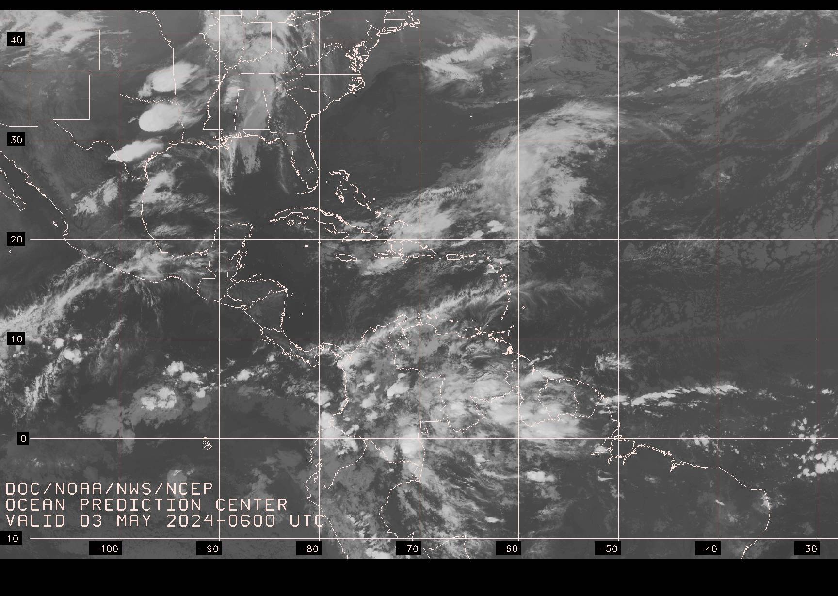
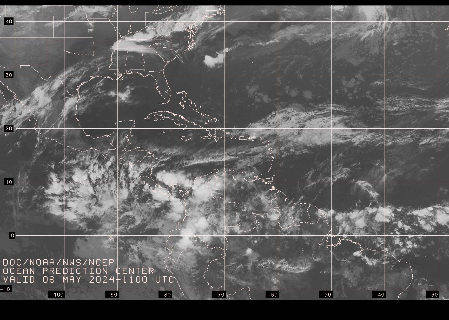
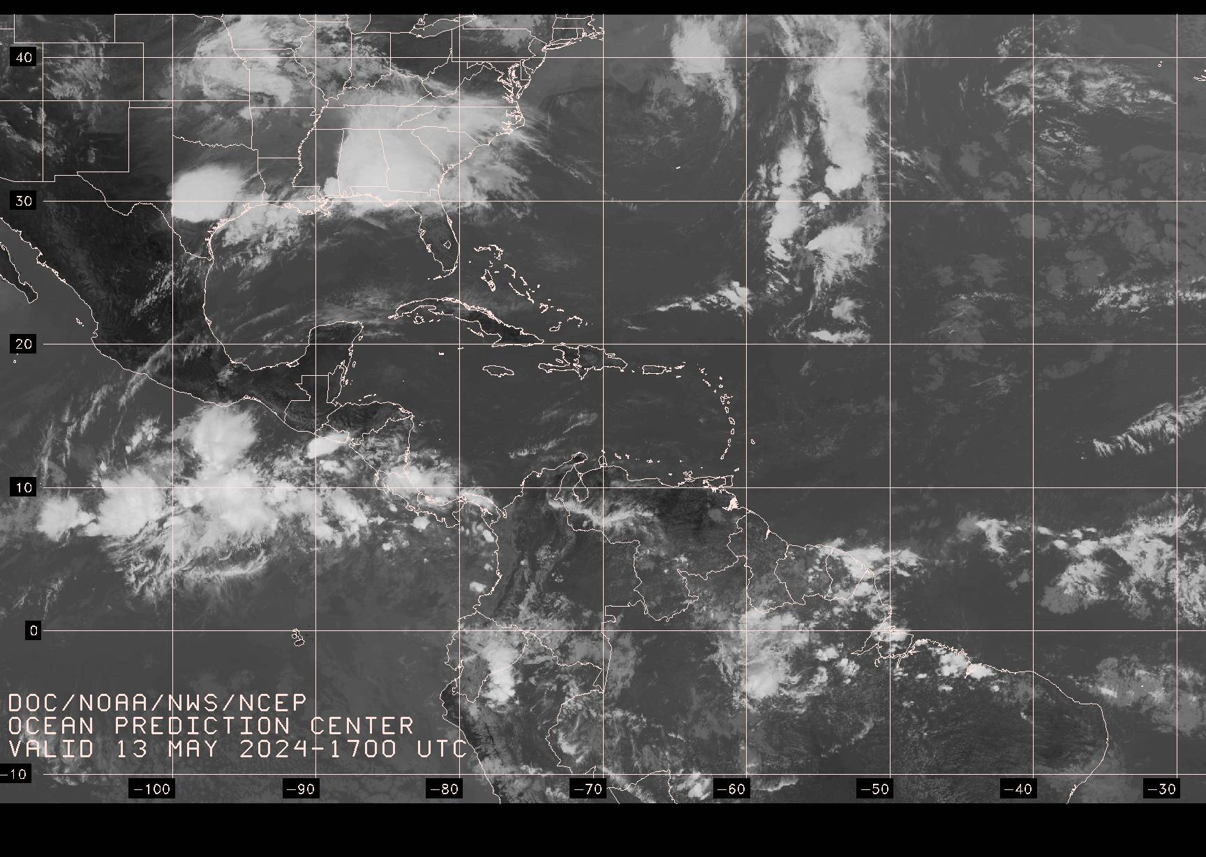
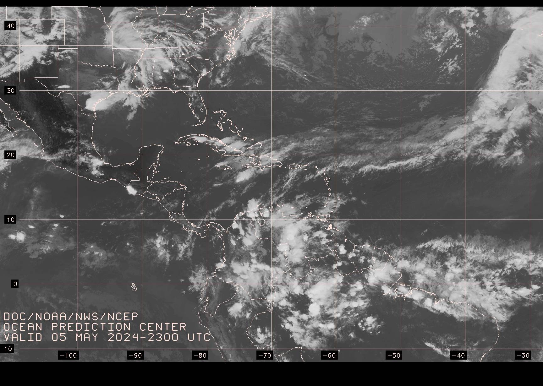
SATELLITE IMAGERY
0645Z GOES IR Satellite Image, 12S-44N, 28W-112W (http://tgftp.nws.noaa.gov/fax/evst06.jpg)
1145Z GOES IR Satellite Image, 12S-44N, 28W-112W (http://tgftp.nws.noaa.gov/fax/ evst12.jpg)
1745Z GOES IR Satellite Image, 12S-44N, 28W-112W (http://tgftp.nws.noaa.gov/fax/evst18.jpg)
2345Z GOES IR Satellite Image, 12S-44N, 28W-112W (http://tgftp.nws.noaa.gov/fax/evst00.jpg)
GOES IR Satellite Image (Most Current) (http://tgftp.nws.noaa.gov/fax/evst99.jpg)
