WIND/SEAS CHARTS
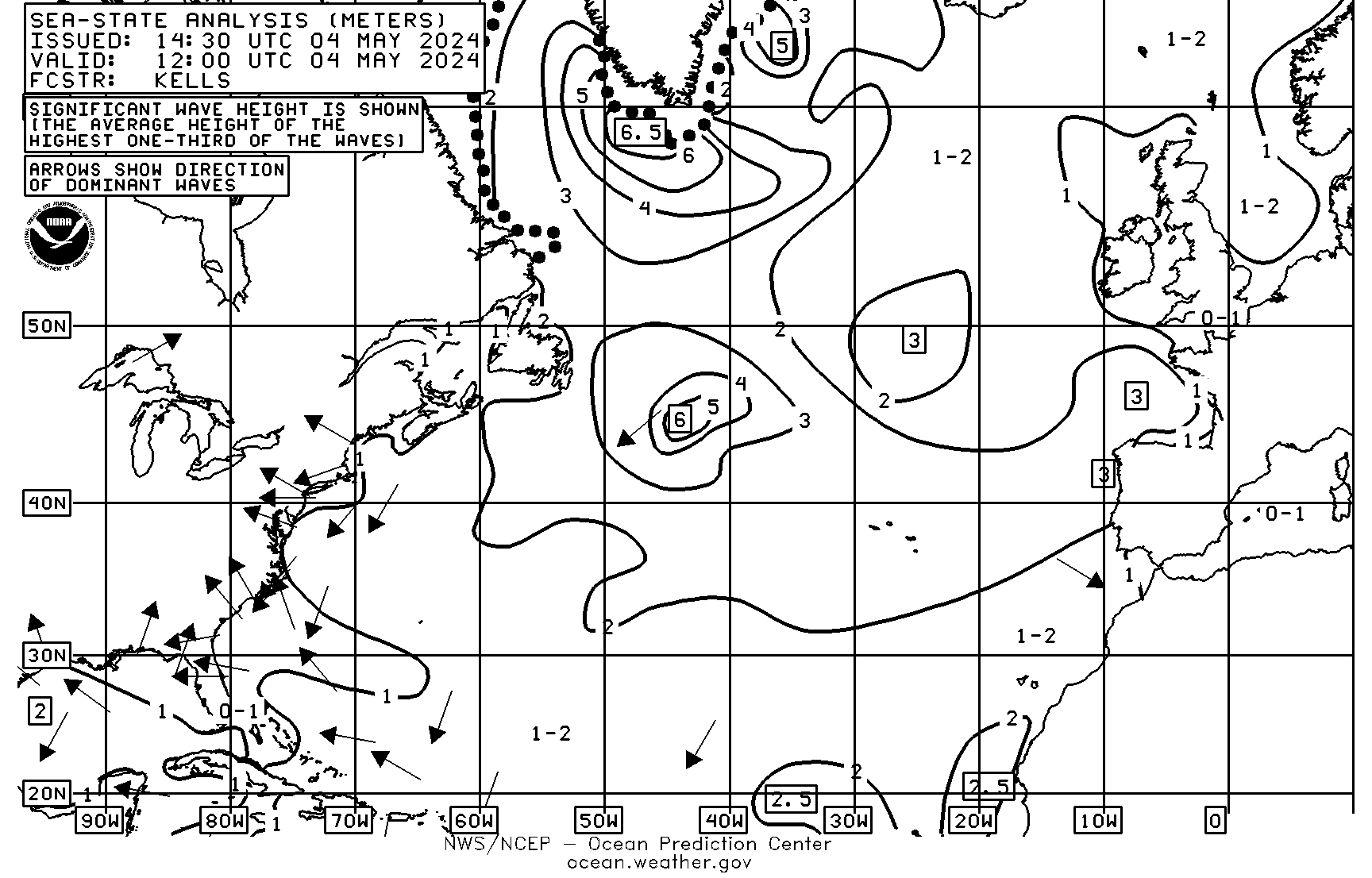
12Z Sea State Analysis, 10E-95W Northern Hemisphere (http://tgftp.nws.noaa.gov/fax/PJAA99.gif)
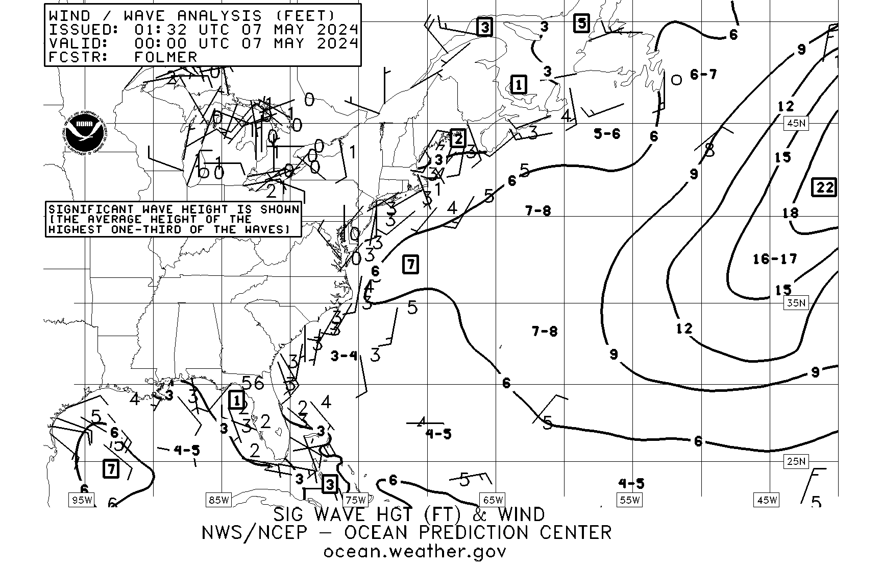
00Z Wind/Wave Analysis, 40W-98W Northern Hemisphere (http://tgftp.nws.noaa.gov/fax/PWAA88.gif)
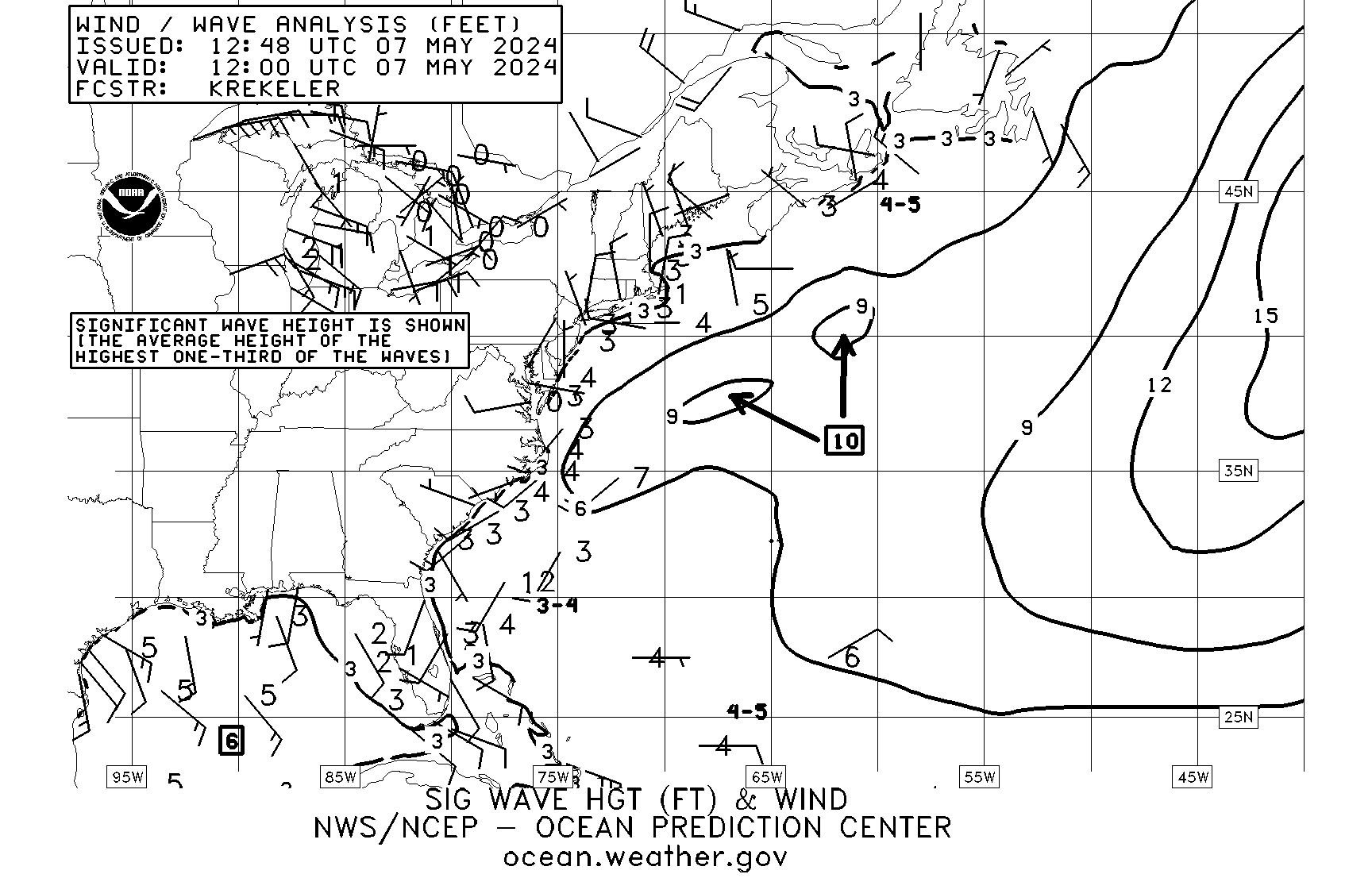
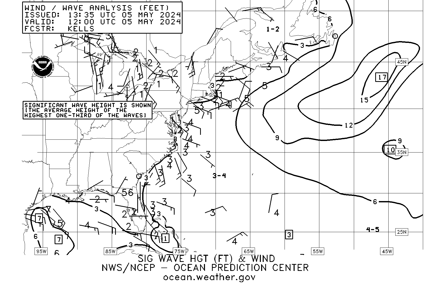
12Z Wind/Wave Analysis, 40W-98W Northern Hemisphere (http://tgftp.nws.noaa.gov/fax/PWAA89.gif)
Wind/Wave Analysis, (Most Current) (http://tgftp.nws.noaa.gov/fax/PWAA90.gif)
24HR Wind/Wave Chart VT00Z Forecast 40W-98W N. Hemisphere (http://tgftp.nws.noaa.gov/fax/PWAE98.gif)
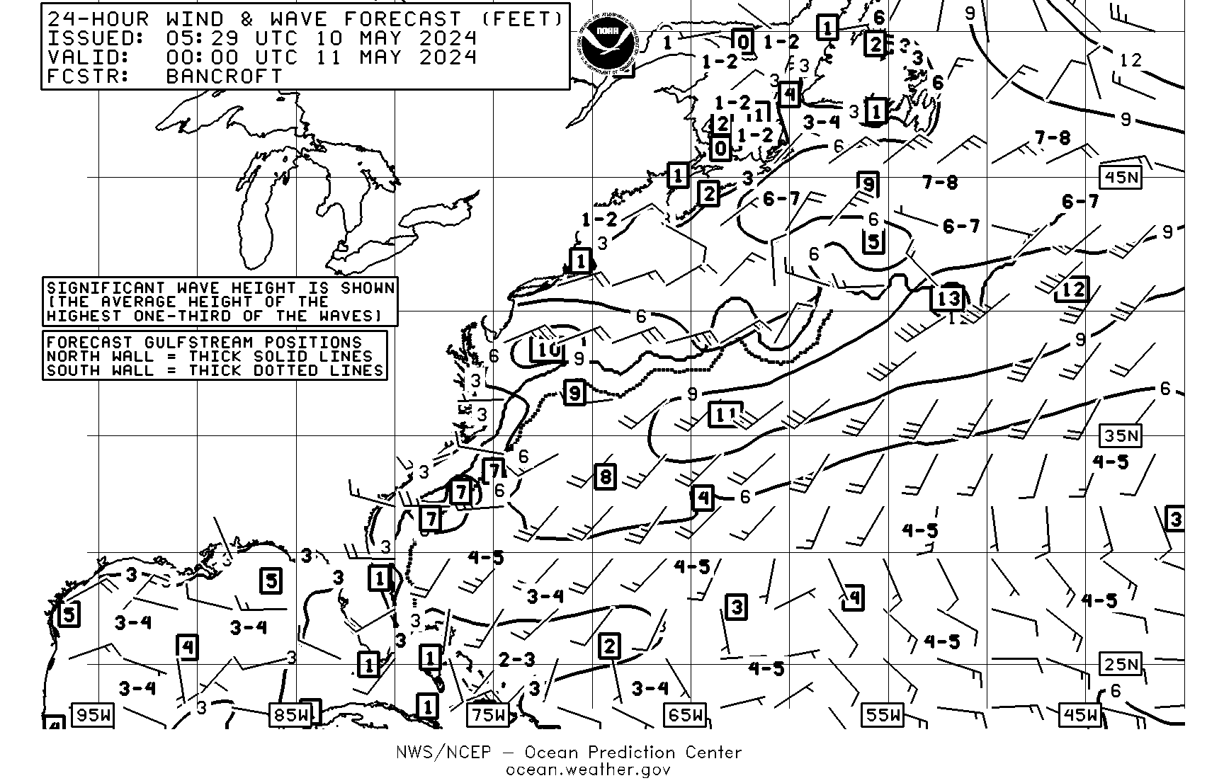
24HR Wind/Wave Chart VT12Z Forecast 40W-98W N. Hemisphere (http://tgftp.nws.noaa.gov/fax/PWAE99.gif)
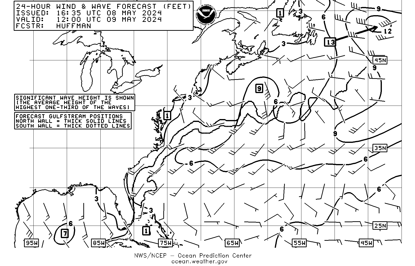
24HR Wind/Wave Chart Forecast (Most Current) (http://tgftp.nws.noaa.gov/fax/PWAE10.gif)

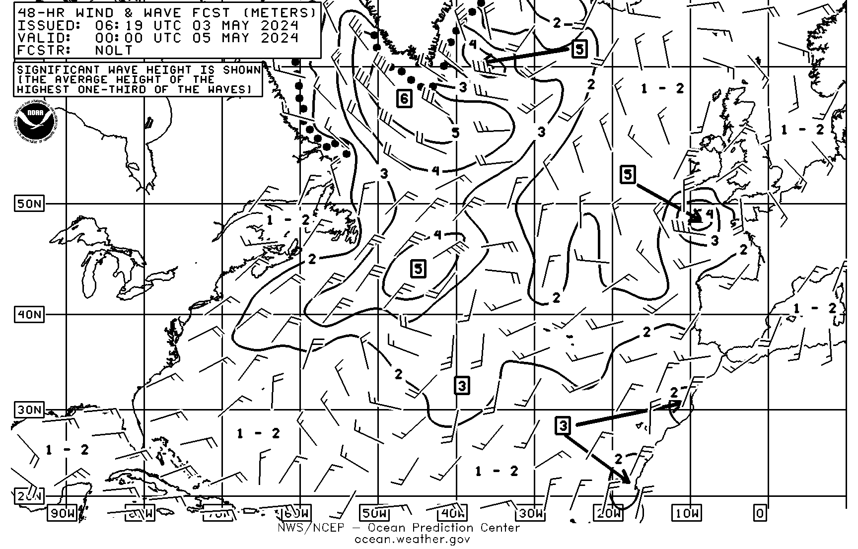
48HR Wind/Wave VT00Z Forecast 10E-95W Northern Hemisphere (http://tgftp.nws.noaa.gov/fax/PJAI98.gif)
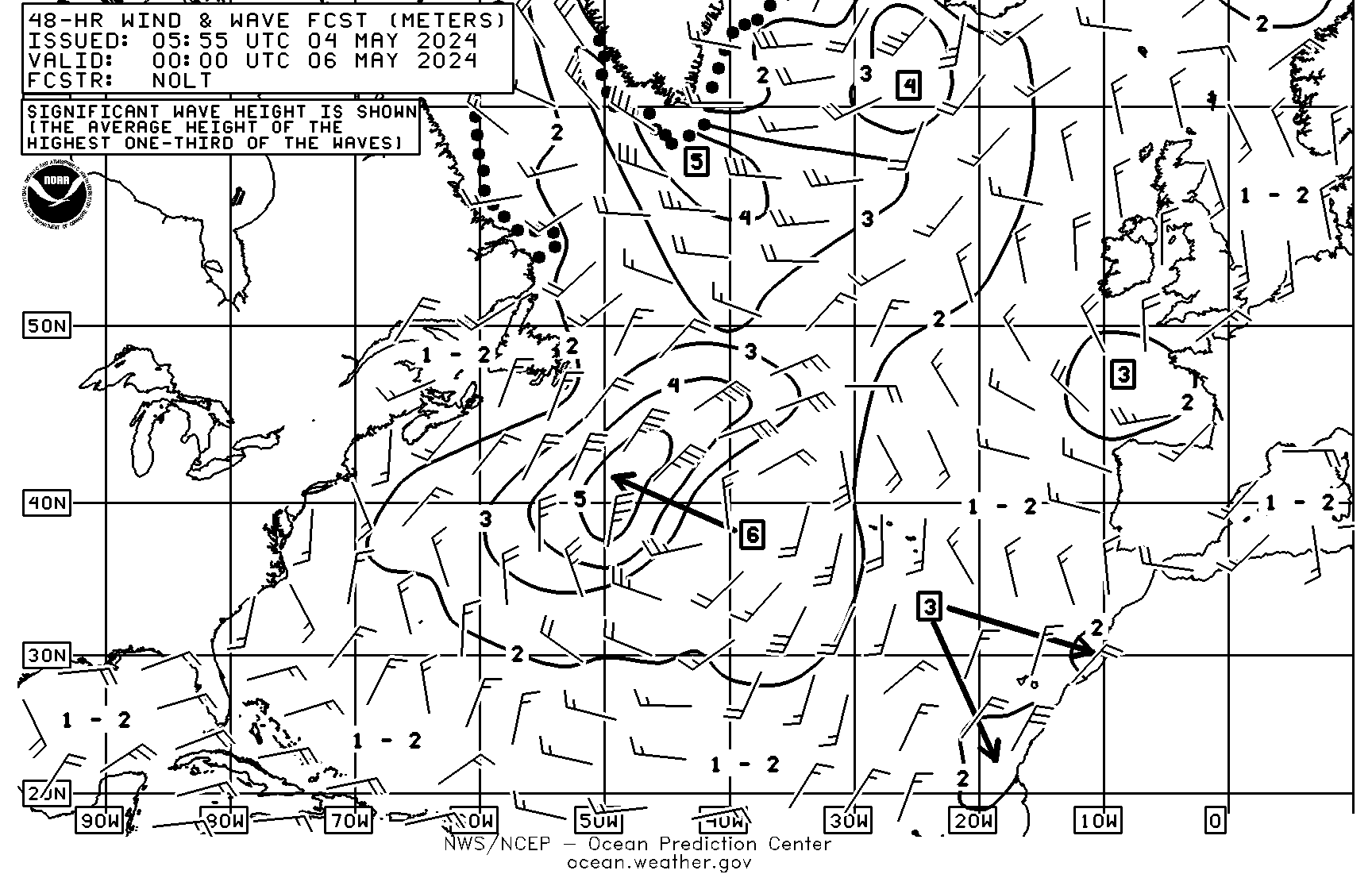
48HR Wind/Wave VT12Z Forecast 10E-95W Northern Hemisphere (http://tgftp.nws.noaa.gov/fax/PJAI99.gif)
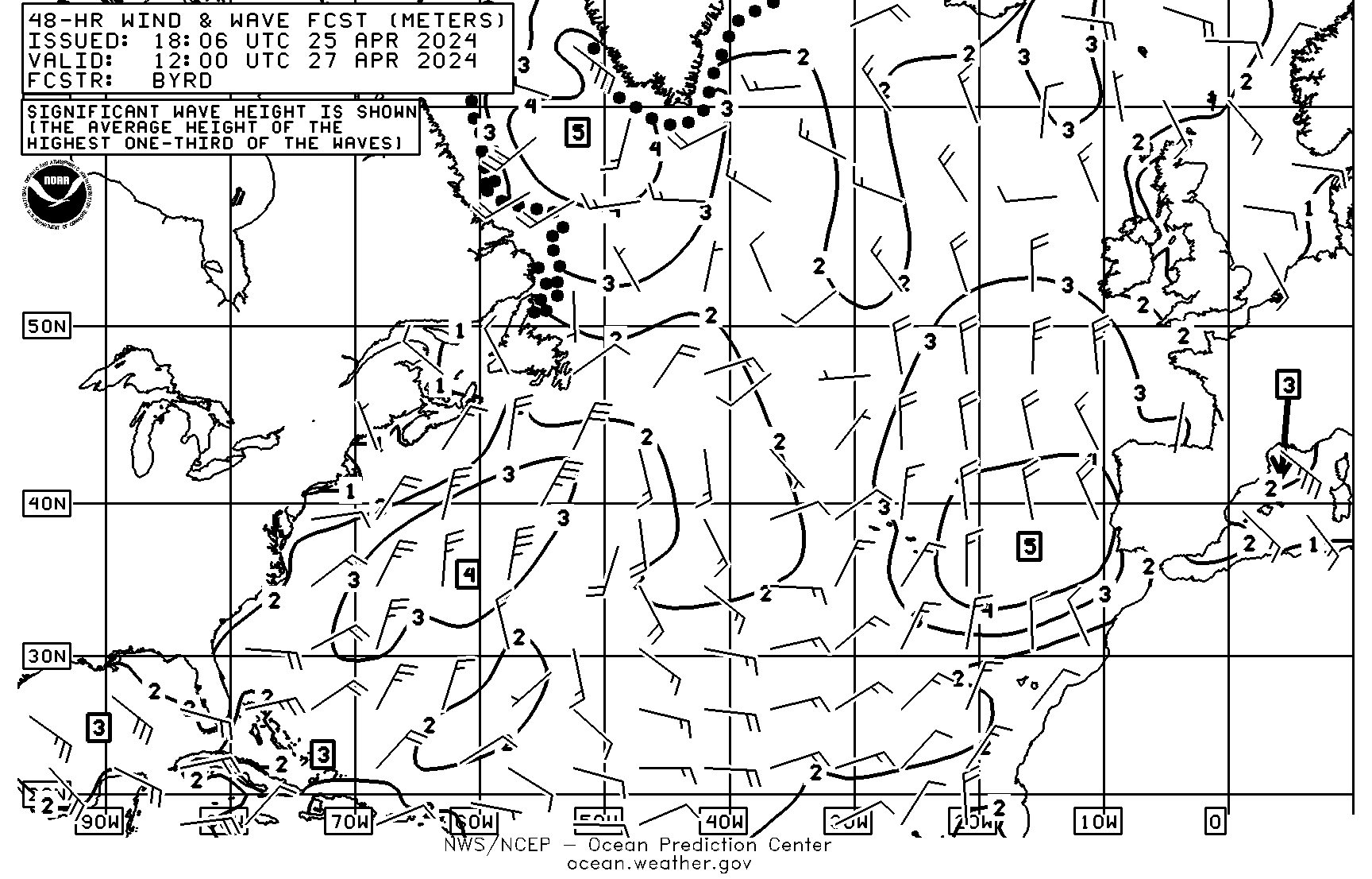
48HR Wind/Wave Chart Forecast (Most Current) (http://tgftp.nws.noaa.gov/fax/PJAI10.gif)
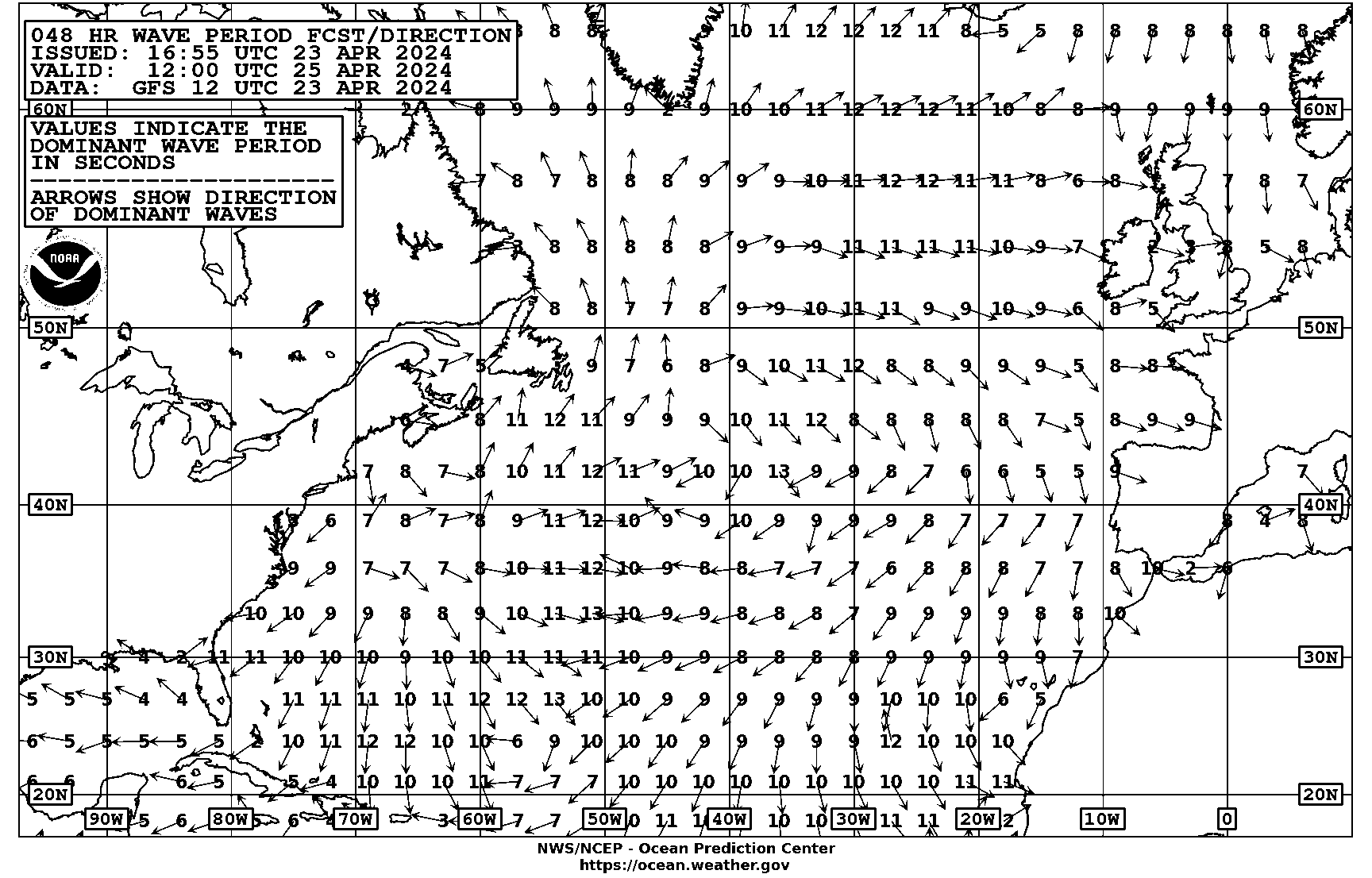
48HR Wave Period VT00Z Forecast 10E-95W Northern Hemisphere (http://tgftp.nws.noaa.gov/fax/PJAI88.gif)
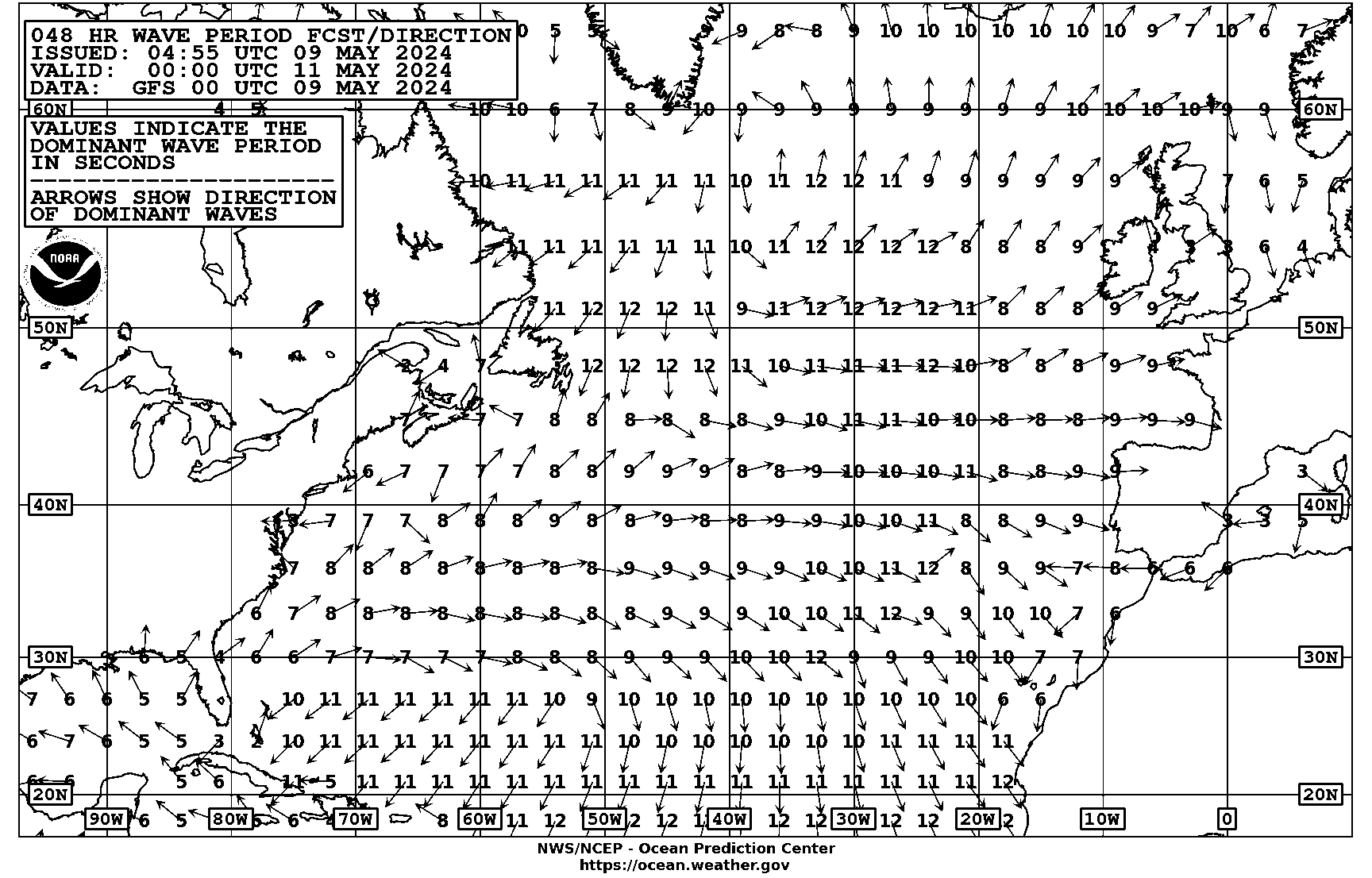
48HR Wave Period VT12Z Forecast 10E-95W Northern Hemisphere (http://tgftp.nws.noaa.gov/fax/PJAI89.gif)
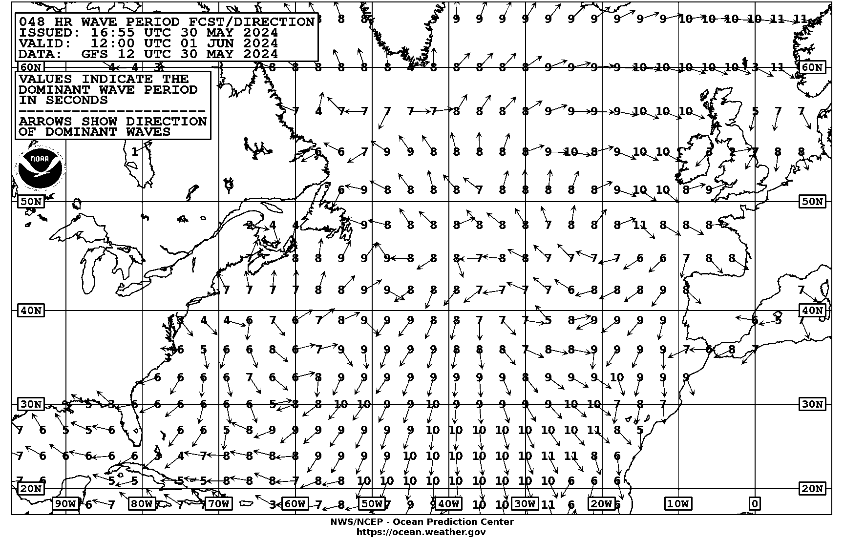
48HR Wave Period Chart Forecast (Most Current) (http://tgftp.nws.noaa.gov/fax/PJAI20.gif)
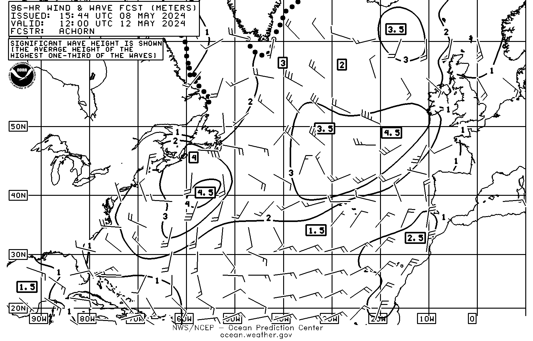
96HR Wind/Wave Chart VT12Z Forecast 10E-95W N. Hemisphere (http://tgftp.nws.noaa.gov/fax/PJAM98.gif)
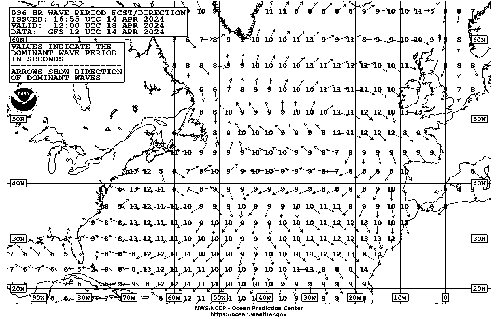
96HR Wave Period VT12Z Forecast 10E-95W N. Hemisphere (http://tgftp.nws.noaa.gov/fax/PJAM88.gif)
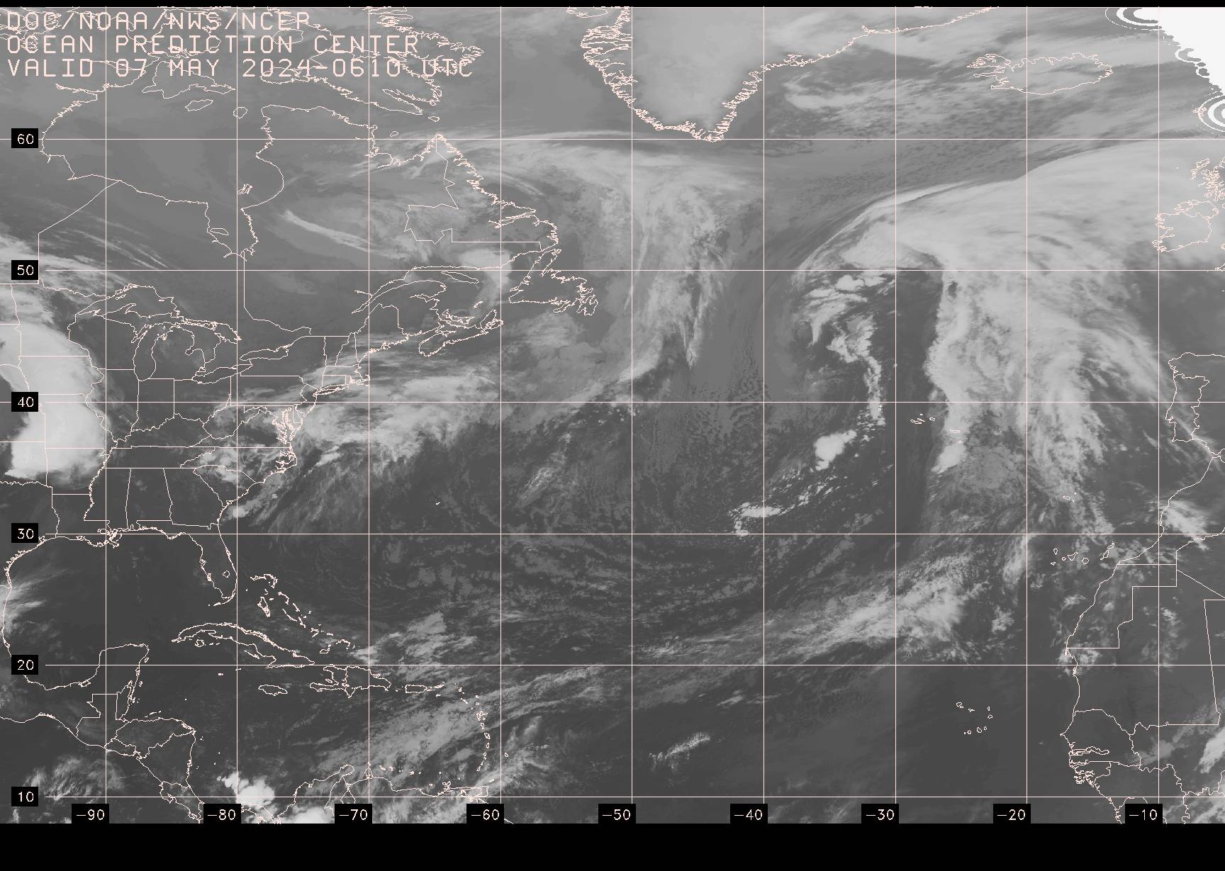
SATELLITE IMAGERY
00Z GOES IR Satellite Image, West Atlantic (http://tgftp.nws.noaa.gov/fax/evnt00.jpg)
06Z GOES IR Satellite Image, Atlantic (http://tgftp.nws.noaa.gov/fax/evnt06.jpg)
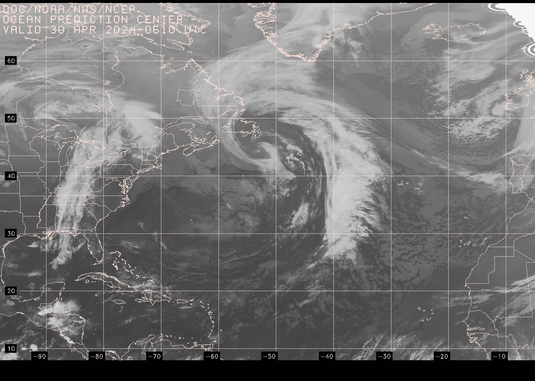
12Z GOES IR Satellite Image, West Atlantic (http://tgftp.nws.noaa.gov/fax/evnt12.jpg)
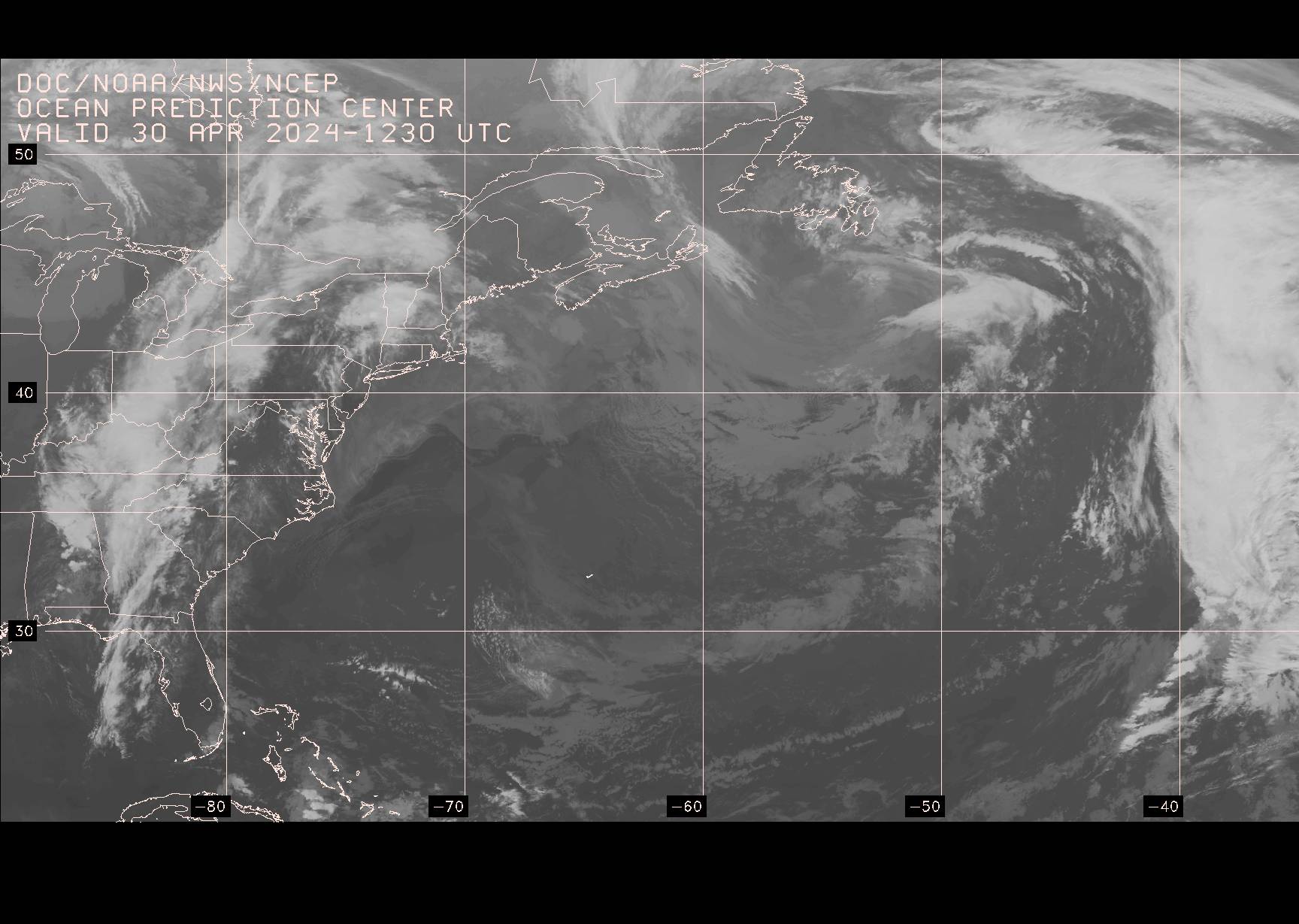
18Z GOES IR Satellite Image, Atlantic (http://tgftp.nws.noaa.gov/fax/evnt18.jpg )
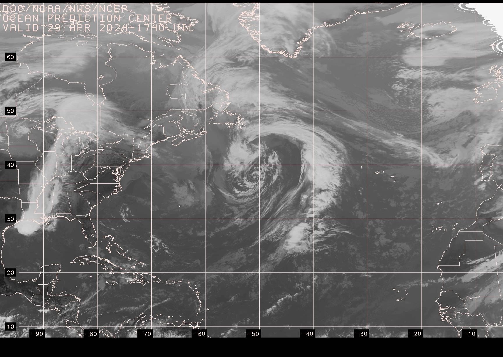
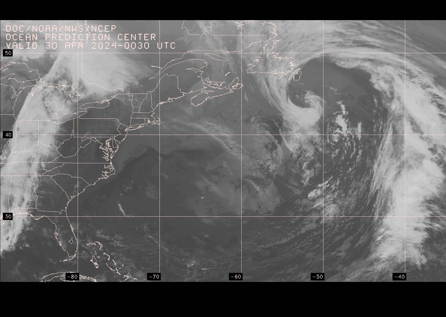
W Atlantic or Atlantic (Most Current) (http://tgftp.nws.noaa.gov/fax/evnt99.jpg)
TROPICAL CYCLONE CHARTS
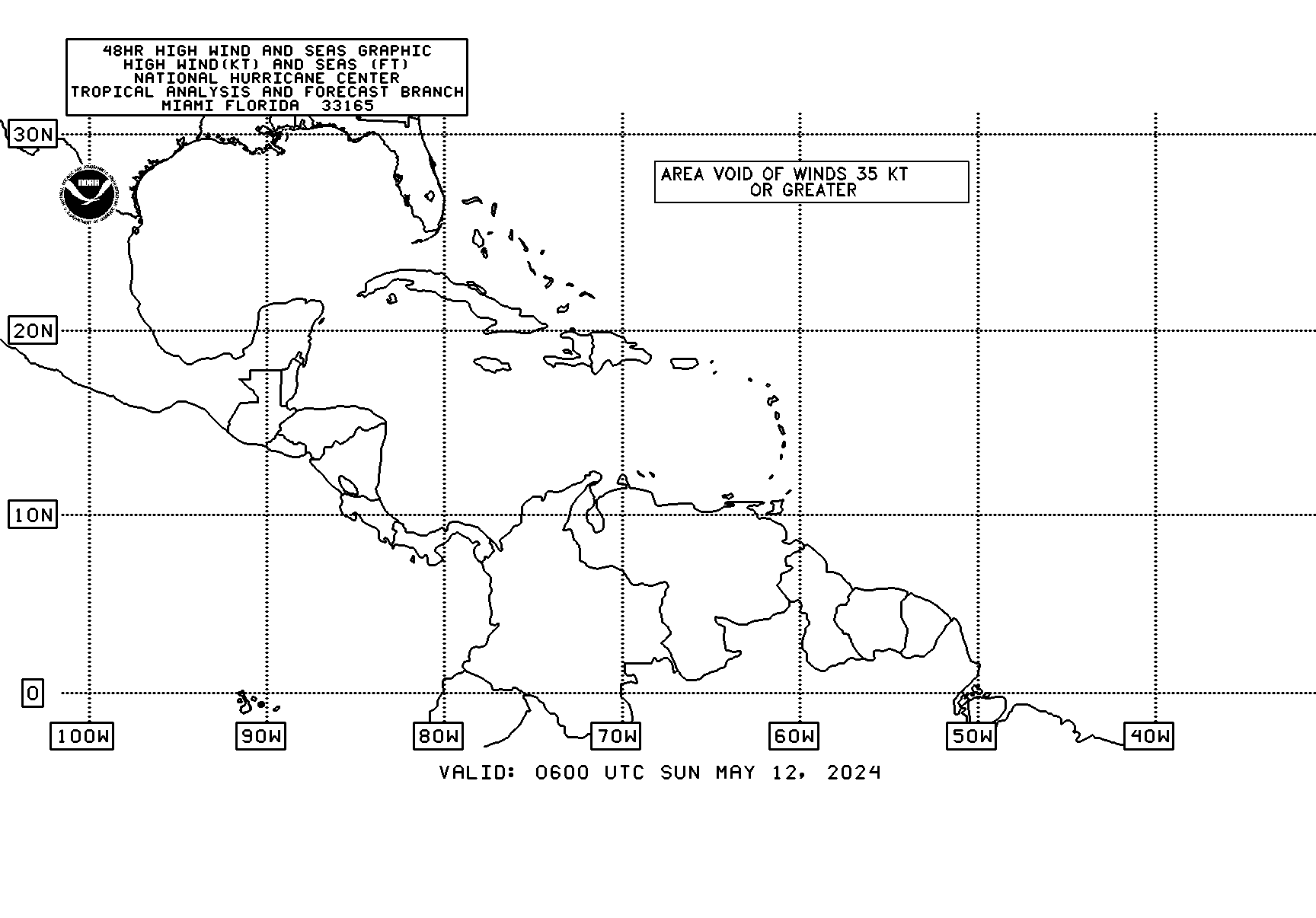
Tropical Cyclone Danger Area* VT03, 05N-60N, 00W-100W (http://tgftp.nws.noaa.gov/fax/PWEK89.gif)

Tropical Cyclone Danger Area* VT09, 05N-60N, 00W-100W (http://tgftp.nws.noaa.gov/fax/PWEK90.gif)

Tropical Cyclone Danger Area* VT15, 05N-60N, 00W-100W (http://tgftp.nws.noaa.gov/fax/PWEK91.gif)

Tropical Cyclone Danger Area* VT21, 05N-60N, 00W-100W (http://tgftp.nws.noaa.gov/fax/PWEK88.gif)

Tropical Cyclone Danger Area* (Most Current) (http://tgftp.nws.noaa.gov/fax/PWEK11.gif)