At San Lucas, the Land’s End of Baja California, we couldn’t make a decision where we want to go: South or North? Depending on when our friends asked a question, we answered to some friends, South and others North. That explains how equally our choices were measured. The sure thing was that (1) we wanted to get out of the hurricane zone, (2) we don’t like the extreme hot weather (Going South), and (3) we read a lot about the difficulties of “Baja Bash” (Going North).
Sailing from San Lucas to the Pacific Coast North (for us to Ensenada) is called “The Baja Bash” because sailors have to go against winds, waves, and currents, mainly motoring the whole distance. Others sail far out to the direction of Hawaii and change the direction (tacking) to California taking double/triple the straight line distance.
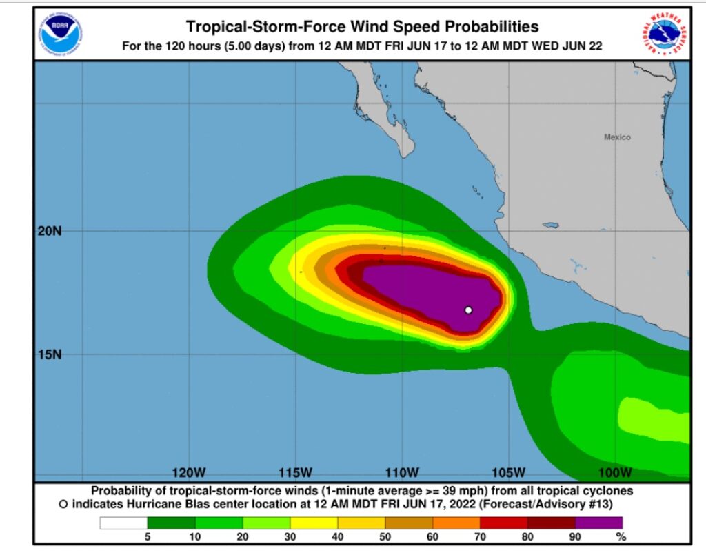
Hurricane “Blas” was at sea moving toward us heading northwest. It let us make a decision; it is North (Ensenada) we go.
***I wrote below so the interested can get different views on the Baja Bash. I previously found five Baja Bash blogs on the internet. We read books and spoke other cruisers who made the bash trip before. Sailing/boating are dynamic sports. Weather constantly changes. Both John and I felt grateful that we made this trip somewhat comfortably. We thanked Bad Bunny and our cats for making it a smooth Bash trip.
(Friday, June 17, 2022, Day 1, Depart San Lucas) We timely checked out the San Lucas IGY Marina when the office opened at 9am. We were ready for Bash Trip and planned to get out the marina at 10am before winds blow stronger. John started the engine. The engine alarm stayed on. During my eight years of sailing, I had never experienced the engine problem until now, just before starting the longest motor trip.
The engine oil pressure sensor gauge is not functioning. After troubleshooting, John concluded we need a new sensor. We rushed to marine store and looked for a replacement part. We visited boatyard and talked some people. Not possible to repair or replace with a new part on time. Our neighboring boat captain offered their spare part, similar to ours, but it didn’t work. Thanks to many people who eagerly helped for us.
Taking a risk (without a sensor), we decided to go ahead with the Baja Bash and left the IGY marina at 12:30pm. Our temporary solution is to stop the engine at sea every six hours and inspect the engine status. Worst case, we can always sail out to deep ocean and zig-zag tacking to the destination. We have an option to sail in this case.
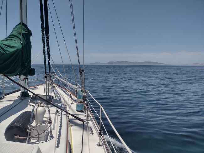
(Saturday, June 18, 2022, Day 2, Arrive Magdalena Bay) It took 31 hours motoring from San Lucas, a total of 174 nautical miles. We dropped the anchor at Man of War Cove in Mag Bay, a blessed and peaceful anchorage for us. The Volve/Penta engine ran at 2,500 rpm speed for this trip motoring close to the shore and burning about 40 gallons of diesel out of 135 gallons.
Thanks (?) the Hurricane “Blas”. It changed the typical weather pattern and brought us fair winds and following seas. We had a six foot big swell pushing behind of us, all the way to Magdalena Bay entrance. It made a moving average of 5.7 knots by a Volvo/Penta MD22a (30 years old, 59 horse power) on a heavy sailboat, Valiant 47.
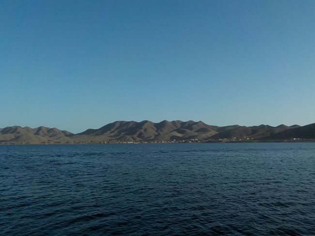
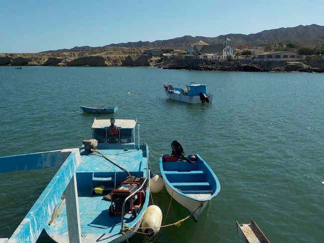
(Sunday, June 19, 2022, Day 3, Enjoying Man of War Cove Anchorage) Magdalena Bay is one of three lagoons for Gray Whale calving on the Pacific coast of the Baja Peninsula. The other two bays are (1) Ojo de Liebre near Guerrero Negro and (2) Laguna San Ignacio. Calving season is around January to March. (Information from Moon “Baja Travel Book”) Whales or not, we are lucky to be here.
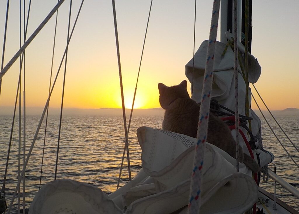
This anchorage was very calm. I even used my laptop writing this without getting motion sickness. Nice cool weather, no heat, no humidity, no sweat, and no swell. The sea water temperature was 68f at noon today. Our cats walked all night on the deck marking foot prints on water condensation, all over on the deck. They like night walks and bird watching at anchorages. Based on their footprints, it looks they walked thousands of steps last night, a lot more than I did. Happy and smiley foot prints!
(Monday, June 20, 2022, Day 4, Depart Mag Bay) Anchor is up at 6am. We started the engine and set at 2400 rpm. “Auto”, our Auto-pilot is driving. Our next destination is Asuncion Bay, about 200 miles from Mag Bay and about 50 miles South of Turtle Bay. We were told the fuel price is better at Asuncion than Turtle Bay. We like to save $$$ whenever we can.
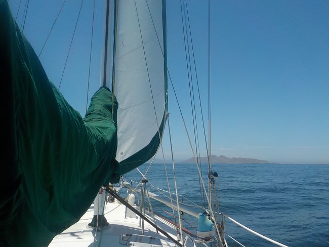
At noon after turning around the point of Santa Maria Bay near Mag Bay, we started to motor sail with the Stay Sail, “Stacey”, as John named it. While Auto and Stacey are working, we noticed that the wind index instrument is not right. Looking at the top of the mast, a portion of it is gone and broken. The big bird must have sat on it last night. The Speed meter is working ok but the direction indicator is not. We now use our senses to tell the wind direction. I periodically moved my face/body to the wind direction.
We didn’t raise the main sail. It is too heavy for me to handle. John’s knee has been swollen and needs RICE (Rest, Ice, Compression, and Elevation). The sea was not comfy to deal with the main sail. It is not a good idea that John goes out on the deck to raise the main sail in this condition. I don’t want to have another “Man Overboard Rescue Experience”, happened about two months ago.
Motor-sailing route is a little off (roughly NNW direction, apparent wind: 10-15 knots) instead of motoring direct (NW direction). But, it will make for less beating. For the next eight hours, we motor-sailed an average 6-7 knots. It was great.
Our cats stayed on the living room (galley) couch covered by a sheet and blanket during the trip. They know when to eat and when to use the litter box between motoring and anchoring. When we arrive at an anchorage, as soon as the engine is off, they immediately come outside, check a new place, and smell new things. Then, eat a lot. Next day, they use litter box more often.
It is time to lower the sails and change the direction. Otherwise, we will land on the shore. Changed to a right direction and continued motoring, hours of it. Thanks to our Volvo/Penta engine working continuously neither taking a break nor complaining.
(Tuesday, June 21, 2022, Day 5, on the way to Asuncion Bay) No dramas. I feel nothing but fortunate. Big swells come and go. I have learned a lot about the weather pattern by looking at the sea. It is dynamic all the time. By looking at the changes of the sea surface I sometimes can guess upcoming weather… I set my watch to beep every 20 minutes and monitor the sea and the boat, in case I am lost in an audio book.
When morning started, I noticed our speed is getting faster. There is a strong current giving us extra 1 to 1.5 knots of extra speed. The sea was grassy calm. We are making 6-7 knots again. We were riding beautiful waves.
As it is calm, I made warm breakfast for me: rice with Miso soup adding some leftover broccoli and an egg. I felt great after warm food. Sea water temperature was 61 Fahrenheit.
At around 11am, I did routine inspection on the boat. One of the places, I often check is under my cabin floor to see if it remains dry, no water (salt or fresh) nor oil of any kind. I saw green liquid swashing under it this time. I woke John up. Anti-freeze liquid was leaking from the container attached to the engine.
As the engine runs, the anti-freeze cools down the engine. However, due to a design fault by Volvo, any air bubbles build up at the front of the heat exchanger, rather than at the anti freeze overflow. Normally this isn’t that much of a problem as we “bleed” off the excess air and the anti freeze then returns to the engine. The problem is that we had been doing so much motoring and John never bled down the excess air, so the anti freeze bubbled out over the top of the overflow container. The engine never overheated, and we were not in any danger.
We turned off the engine and let the boat freely move. Auto was steering the course without the engine running, just pushed along by the currents. It let us keep going at 1.5 knots while the engine was off. John opened the air bleed bolt of the heat exchanger. We could hear it hissing out air as the anti freeze came down from the overflow tank. John, not being the most patient person in the world, opened the bolt further. Oops, it came totally out of the heat exchanger and poured hot anti freeze all over his hand. He used many words that are useful to sailors and mechanics all over the world. John calls them “Power Words”. We poured more fresh liquid in the container and started the engine.
In the afternoon, as the winds slowly began turning from back of the boat to side to front, we lost some speed. It was still making 5 to 6 knots. We made to our destination at 7pm, just before sunset. As we are settled, the fuel service guy (Lery Espinoza) came to us by his dinghy. We arranged the fuel delivery with him for next day. His information is on the Navionics chart on iPad; call VHF channel 16 or his cellular number.
(Wednesday, June 22, 2022 Day 6, at Asuncion Bay) We gave cash (7,000 Pesos diesel = about 350 USD) to Lery for the fuel purchase. He brought about 300 liters (78 gallons) of diesel in his and our jerry jugs. He gave us the receipt from the fuel station. Fuel price in Mexico has been steady since we’ve been in Mexico (about 15 months), unlike in the States. The diesel was 23.59 pesos per liter at the gas station. His service fee is $1 for one gallon. It is a good deal for us as he did hard work. After including his service fee, we still like the actual fuel price which ended up $5.26 per gallon. Lery speaks good English.
<Trip Summary from San Lucas to Bahia Asuncion>
- Total Fuel Usage: 88 Gallons
- Travel Distance: 392 Nautical Miles
- Miles per Gallon: 4.45 Nautical Miles
- Moving Average (San Lucas to Mag Bay): 5.7 knots
- Moving Average (Mag Bay to Asuncion Bay): 5.8 knots
We stayed in Asuncion Bay for three nights waiting for good weather window for next stop, Turtle Bay. John’s knee is still a problem so we didn’t take the dinghy down to visit the town. We were also tired after hearing the engine sound for days. Sailboat is not designed with great engine sound proofing.
(Saturday, June 25, 2022, Day 9, Arrive at Turtle Bay) At sunrise, we left Asuncion Bay and arrived in Turtle Bay 3:30pm. We stayed here for two nights. I used water taxi service by Enrique to visit the town. It was warm in Turtle Bay. There were many kids and teenage children visiting the beach swimming. Turtle Bay is huge. I also saw many camping vans and RVs on the shore for the weekend nature outing. We didn’t get the diesel in Turtle Bay because we filled in Asuncion Bay.
<Trip Summary from Asuncion Bay to Turtle Bay>
- Total Fuel Usage: 12.7 Gallons
- Total Distance: 54 Nautical Miles
- Travel Time: 9 hours
- Moving Average Speed: 6 Knots
- Miles per Gallon: 4.5 Nautical Miles
- Diesel Usage by Hour: 1.41 Gallons
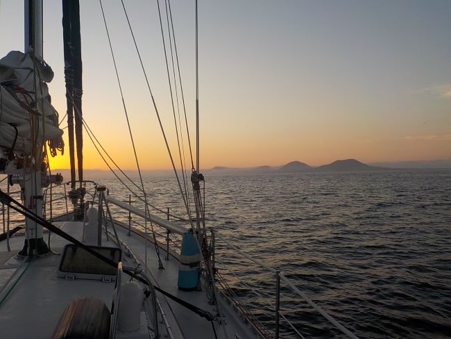
(Monday, June 27, 2022, Day 11, Depart Turtle Bay): At dawn, we raised the main sail. In the morning, we had south swell helping us going north. The swells are from the hurricane “Blas” and maybe “Celia”. It is amazing how far the hurricane impact is felt when you are at sea.
Between Turtle Bay (Baja South State) and our next destination (Baja State), time changed, one hour back so we gained one hour. At some point of the time, the South swell slowly disappeared. We don’t have the hurricane weather advantage.
I originally wanted to pass west of Isla Benitos but I wasn’t sure about some areas with lots of kelp beds and obstructions showing on the chart. We changed our course to pass between west of Cedros Island and east of Isla Benitos.
Late afternoon, we started to feel the counter-current. It continued the rest of the trip. We are losing 1 to 2.5 knots from the counter-current. As the wind direction and swell kept changing, I did lots of exercise by letting out the sails and rolling in, repeating it whenever the weather changes. Next day morning, we sadly rolled all sails in and just let the engine drive the boat.
It is about time. I was happy to see sapphire clear blue water. We also started enjoying the sea lions or seals playing on the water surface here and there. Maybe our attitude was bad or what. During whole trip in the Sea of Cortez, we didn’t think the sea water was beautiful. It was greenish with lots of nutrients. Not at all like the gin clear water of the Caribbean or the Bahamas.
We are not sure if we were at wrong time or at the wrong place, we rarely saw fish in the Sea of Cortez. I read an article mentioning that there are lots of fish in the Sea of Cortez saying that you catch whatever you want to eat for dinner. Not happening in our life there. We gave up catching fish a while ago. During this trip, we didn’t try to catch fish. We were focused on going through this Baja Bash, as comfortable as possible. Maybe we are getting lazy. I don’t like to deal with fish cleaning in the cockpit either. Hopefully, fishermen can catch more.
After leaving the Turtle Bay, we often saw floating kelp. I was concerned about kelp getting caught on the propeller. John didn’t think so. We have a spurs (cutting device) installed on the propeller shaft.
(Tuesday, June 28, 2022, Day 12, Arrive San Quintin Bay) We made it to San Quintin Bay late evening. It was a concern if we arrive at a new anchorage at dark because we had been slowed down by the counter-current. Gaining one hour of daylight was good but the sun was going down when we arrived.
The bay confused us because the shore was very low looking like the sea. There are three volcano mountains close to the bay. John wasn’t sure how the chart shows differently as we didn’t see the low land shore on the west where sun was going down. I used the binocular and identified the low land shore on the horizon. We are safe staying here tonight.
As we letting the anchor down, small black flies flew to the boat brought by the wind and started biting us. There is a sanctuary lake not far from the anchorage. We closed all the side windows only opened the top doors (hatches) with bug screens. We just hope we don’t get swells in the anchorage and rest for a good night. Nothing but pray for calm anchorage, I thought. It worked.
<Trip Summary from Turtle Bay to San Quintin>
- Total Distance: 186 miles
- Travel Time: 38 hours
- Moving Average: 4.9 knots
(Wednesday, June 29, 2022, Day 13, Depart San Quintin Bay) First thing is first! I download the weather. There will be strong headwinds at least for a week. San Quintin anchorage was nice to us last night, but we don’t know how it will change with strong winds. We have to arrive in Ensenada before headwinds blow hard. We want to be in Marina Coral in Ensenada tomorrow morning before strong winds start.
The distance from San Quintin to Ensenada is about 100 nautical miles. Knowing the count-current, we left the bay at 8am, assuming 24 hour trip to arrive at the Marina Coral when they open at 8am.
At sea, John and I take a turn to watch the boat every six hour. I am responsible from 2 to 8 o’clock and John is on 8 to 2. During the day, the speed of the boat was 3.5 to 4.5 knots because of the counter-current. I took over at 2am, still going slow. Soon, I noticed the boat is going faster and faster. No more counter-current. Actually the current was pushing us. We will be at the marina too early. I lowered the engine RPM at 2,000. Night was pitch dark. Getting close to Ensenada Bay, I see three lights blinking from an island and also the other side of Baja land. Charts show clearly how to navigate in the bay between lights. I decided to wake John up to handle the situation together: (1) Much early arrival at dark and (2) Scary darkness passing between lights.
(Thursday, June 30, 2022, Day 14, Arrive Marina Coral in Ensenada) We slowed and slowed the boat but arrived at the marina before it opened. We managed to dock at the marina fuel station. I did lasso loop to tie the boat to the dock while John is maneuvering the boat. When the marina opened, we were told that the diesel was not available. They have a truck delivery scheduled today. I assume a big yacht took all the fuel.
<Trip Summary from San Quintin Bay to Marina Coral in Ensenada>
- Total Distance: 109 Nautical Miles
- Travel Time: 22 hours
- Moving Average: 4.9 Knots
After docking the boat in an assigned slip, marina employee took us to the immigration office and the port captain’s office. After return, we gave Bunny a fresh water shower. We are cleared. Boat is clean. Then, I searched an orthopedic surgeon for John’s knee problem, appointment set for tomorrow.
It is time to celebrate our journey. Marina has great facility in the hotel resort and nice buffet restaurant. I can handle buffet food. When entering the restaurant, someone was calling my name. A cruiser couple (Crystal and Kurt) we first met two months ago, asked us to join their table. Yum yum yum… They did Baja Bash a couple of weeks earlier than us. We both have common things to talk about.
Late afternoon, Crystal and I went to the pool bar for our welcome drink. I watched the bartender pouring a good portion of Jose Cuevo Tequilar and Orange Liquior Cointreau. Good choice. I am not a margarita/cocktail drinker but it was yum. It really mellowed me. Glad to be here.
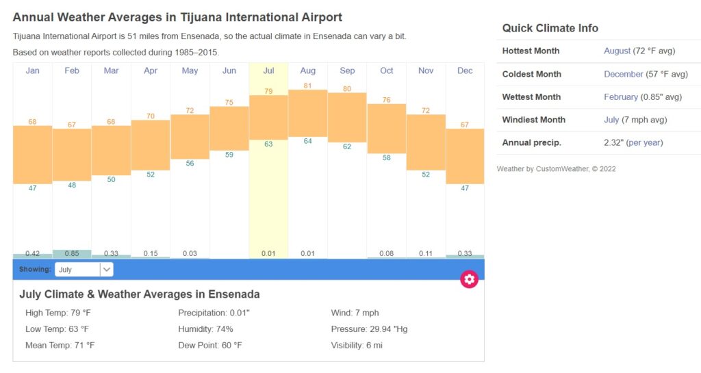
<Trip Summary from San Lucas to Ensenada>
- Total Moving Distance: 741 Nautical Miles
- Total Moving Hours: 137 Hours (Started on June 17 and Finished on June 30, 2022)
- Total Moving Average Speed: 5.4 Knots
- Total Diesel Usage: 173 Gallons
- Average Diesel Usage by Hour: 1.29 Gallons/Hour